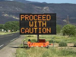
 As of 8:00 am this morning (June 11, 2018), NM 64, between Cimarron and Eagle Nest is open. Crews have been and are working day & night to ensure safety in the Cimarron Canyon. Please use caution and patience and be prepared for delays. NM 204 remains closed at this time. Evacuations of Cimarron, Philmont Scout Ranch and Ute Park have been lifted and all of their residents have been able to return to their homes. The fire has burned 36,740 acres and is 77% contained. Angel Fire and Eagle Nest are in no danger from this fire, events planned are still happening, so there is no need to change your vacation/travel plans. However, at least this week, you may still want to take alternative routes to get up here. Be patient and expect heavy slower traffic and to add a little extra time to your travels which ever route you decide… it is well worth it!
Optional driving routes due to NM 64 closure:
NM 120: From Interstate 25, take the Wagon Mound Exit and head WEST on state road 120 to Ocate which is approximately 23 miles and takes about 26 minutes. From Ocate you can continue on 120 all the way to state road NM 434 and then into Angel Fire. There is a 12 mile stretch once you are up in the mountains that is rough and rocky and very narrow. You do not need a 4WD but if your tires are in poor shape, this route is not advised. Nor would we advise RV’s or vehicles pulling trailors to take this route. On www.nmroads.com it says: NM120 from mile marker 4 to mile marker 12, unpaved road, may be impassable in inclement weather- proceed at your own risk.
NM 434: If you have followed the direction from above to Ocate, as you get into Ocate, take a LEFT onto state road 442 to La Cueva which is 23 miles/takes 26 minutes. At La Cueva, take a RIGHT onto state road 518 to Mora which takes 7 minutes. In Mora, take a RIGHT onto state road 434 to Angel Fire which is 34 miles, takes about 48 minutes. At mile marker 19 there is a very short stretch of unpaved road that should pose no problem. Once past that, the road does become narrower with no shoulder until after mile marker 23. If you are driving a very large RV and feel you would not be comfortable on this narrower section of NM434, your alternative would be to continue on through Mora on state road 518 to Taos which is about 48 miles/ 1 hr. 10 min. In Ranchos de Taos turn RIGHT onto NM 68-N, then follow directions below. From this point it is 26 miles, 45 minutes to Angel Fire.
From Taos: On NM 68-N turn RIGHT at the Taos Visitor Center onto NM585. At the dead end turn RIGHT on NM 434. Once you are on NM 434, it is a paved, winding 2-lane mountain pass. This route is 37 miles, takes about 35 minutes depending on traffic flow.
I ran this ad in the eBlast on ironically, the Monday before the Ute Fire started, I was asked to re-run it. As we now know, it can happen again in an instant… one tiny spark of flame.
Please be aware and please take this very seriously. Angel Fire, Colfax County, Taos County and Carson National Forest are all under a BURN BAN.
Inform your family, guests, renters and neighbors. Thank you!
Leave a Reply